

3D Geo Globe

Deskripsi 3D Geo Globe
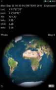
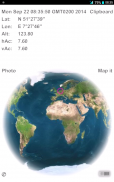
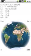
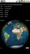
This GPS tool shows an accurate NASA longitude latitude map projected onto a 3D globe of the earth. A small pink indicator circle pinpoints your current geo-location based on received GIS GPS data or on a triangular wi-fi calculation. Save a photo for mail or for album geo tagging.
User Manual and Features:
* tap the clock to toggle GMT & UTC displayed time and hidden.
* tap Lon & Lat (Latitude or Longitude) to display the pink indicator in the center. Tap again to switch conversion from Decimal Degree to DMS (Degrees, Minutes, Seconds).
Note: choosing this mode while flying transcontinental will show the earth rotating under the indicator.
* swipe to the east & west for a spinning globe, tap the globe to hold the current rotation.
* tap Alt (altitude) to switch from meter to feet (see feet ' character) or hidden. Same behavior for tapping though vAc (vertical accuracy) and hAc (horizontal accuracy) combined.
* tap on m/s (meter per second) speed will switch to kmh (kilometer per hour) and tap again to fps (feet per second) and to mph (miles per hour) and kn (nautical knots) and to blank
* The 'map it' button takes you to the respective google map in your browser or Maps app
* All of your settings will be saved automatically
Tip: The blank (hidden) options can be used for manipulation of the captured photos. Which info would you like to reveal?
Tap on the miniature © in the corner to find out about the author ... tap again to hide. All other buttons are suspended during this display.
The ©, 'map it' and 'photo' and switch background color button will not be captured by the photo option.
After clicking 'photo' you'll get a 'saved' or 'error' prompt, click again to activate the photo option anew.
Turn on GPS for best results!
Adobe AIR android 2.2 up
Alat GPS ini menunjukkan akurat NASA bujur lintang peta diproyeksikan ke dunia 3D bumi. Sebuah kecil merah muda indikator titik-titik lingkaran Anda saat geo-lokasi berdasarkan data yang diterima GPS GIS atau pada segitiga perhitungan wi-fi. Menyimpan foto untuk mail atau untuk album geo tagging.
User Manual dan Fitur:
* Sentuh jam untuk beralih GMT & UTC ditampilkan waktu dan tersembunyi.
* Tekan Lon & Lat (Lintang atau Bujur) untuk menampilkan indikator merah muda di tengah. Ketuk lagi untuk beralih konversi dari Gelar Desimal ke DMS (Derajat, Menit, Detik).
Catatan: memilih mode ini saat terbang lintas benua akan menunjukkan bumi berputar di bawah indikator.
* Menggesek ke timur & barat untuk dunia berputar, tekan dunia untuk menahan arus rotasi.
* Tekan Alt (ketinggian) untuk beralih dari meteran ke kaki (melihat karakter kaki ') atau disembunyikan. Perilaku yang sama untuk menekan meskipun Vac (akurasi vertikal) dan HAC (akurasi horisontal) dikombinasikan.
* Tekan m / s (meter per detik,) kecepatan akan beralih ke kmh (kilometer per jam) dan tekan lagi untuk fps (kaki per detik) dan mph (mil per jam) dan kn (knot laut) dan mengosongkan
* The 'peta itu' tombol akan membawa Anda ke masing-masing peta google di browser atau aplikasi Maps
* Semua pengaturan akan disimpan secara otomatis
Tip: kosong (tersembunyi) Pilihan dapat digunakan untuk manipulasi foto yang diambil. Yang Info Anda ingin mengungkapkan?
Tekan pada miniatur © di sudut untuk mencari tahu tentang penulis ... tekan lagi untuk bersembunyi. Semua tombol lainnya ditangguhkan selama layar ini.
© The, 'peta itu' dan 'foto' dan beralih tombol warna latar belakang tidak akan ditangkap oleh foto pilihan.
Setelah mengklik 'foto' Anda akan mendapatkan 'disimpan' atau 'kesalahan' prompt, klik lagi untuk mengaktifkan pilihan foto baru.
Hidupkan GPS untuk hasil terbaik!
Adobe AIR android 2.2 up


